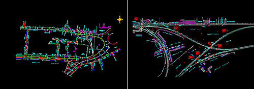
Methodology of Survey – Topography and Mapping
Specialist in,….
Topograghic & Engineering Surveys With Advance-Electronic
Equipment & Cadd Drawings, also Consultant On…
Topographic,Contour
Town Surveys & Village Lands,
Road, Railway, Pipeline,
UGD-System, Property, Layout, Building Setout,
Industrial, Farm Lands, Hills Area,
Power Transmission Line, Canals
Sewerage Water Line, Factories & Existing Building Plans _Etc………..And Perfect Mapping Through Software In Computers Plotters.
Highways – Road Projects:
Topography & Mapping for Road, Railway, Bridge, and Pipeline Projects.
The survey shall be carried out using high precision instruments such as Electronic total Stations and Auto Levels.
The Survey shall be based on closed traverse, which shall be tied up to permanent Control points/pillars.
The Accuracy of Traverse and Leveling shall be followed as per norms.
The Survey shall capture all indemnified topographical features within the limits of ROW.
Levels along the road alignment shall be taken at regular intervals of 50 m (or as reqd.) and at closer interval in built up and curve areas.
Cross sections shall be taken at intervals of 50m (or as reqd.) and at closer interval in built up and curve areas.
River/channel cross-sections shall be taken at every 50m intervals up to a distance of 200m(or as reqd.) on u/s. and d/s from edge of the end.
Following land features shall be captured and presented in drawings, All the notations/symbols (Legends) shall be as agreed with the Client in advance of the execution.
Existing road pavement surface, earthen shoulder and its variation in width along with all other pertinent road details – Centerline of Carriage way, Pavement edge, shoulder edge, embankment/Cutting edges top and bottom, side drains, signs, Km stones/posts etc.
Location of traffic islands, median, rotaries, police chowks, within limits of ROW.
All religious places – temples, mosques, churches, graveyards etc., including location, building lines and clear dimensions of compound walls and extensions.
Location of roadside drains, clearly indemnifying the type (open/close), width of drain, including the beginning and end of drains. All water features within ROW i.e ponds, lakes, streams, canals shall be recorded.
Identification of all bridges, culverts and other structures along the alignment – the details recorded shall include the chain age, width of bridges/culvert, (Width of slab or diameter of pipe), Course of water path, skew of bridge/culvert, span arrangements.
Details of Right-of-Way border stones, supplemented as required with information from Land Revenue Offices for location of missing stones.
Trees (Position and species)
Railway level crossings.
Any over crossing or under crossing of the road by road or rail.
All electricity lines, telephone lines, OFC lines, Private OFC lines, Water pipes above and below the ground belonging to Towns, Villages, Zilla Panchayats and other bodies. For this purpose, it is the responsibility of Consultants to get details from concerned authorities.
Geographical Position System (GPS) Co-Ordinates of the Project Road shall be established using GPS.
Cross sections
Cross-Sections shall be taken at intervals of 50m, reduced to 25m on curves of less than 1000 m radius. Cross-sections shall also be taken at the center line of all culverts. The cross section survey shall include the following.
For Existing Road
» At centerline of existing carriageway.
» At carriage edges.
» At paved shoulder/earthen shoulder/footpath edges.
» At intersection of embankment/cut with natural ground
» Further points at 10m interval or at location of change in ground, up to 5 m beyond the Right of way.
For Culverts
» At centerline of existing carriageway.
» At carriageway edges.
» At paved shoulder/earthen shoulder/footpath edges.
» At top of headwall.
» At culvert invert level.
» At points up stream & down stream along the channel up to 5m beyond ROW.
» River/Channel cross-sections shall be taken at every 10m interval up to a distance of 50m on u/s and d/s from the edge of the road.
|